Die nächste Perle auf meiner Reise durch die Südsee ist Taveuni. Die Garteninsel, durch die der 180. Längengrad verläuft, ist einfach nur paradiesisch. Bei einer Wanderung zu den drei Wasserfällen im Bouma Heritage Park lege ich meinen Wanderstein FIJI 2025 am ersten Wasserfall ab. Der wird denn auch sogleich von Angelica, einer achtjährigen Fijianerin gefunden und sie wird ihn mit nach Hause in ihr Dorf nehmen. Es gibt fürwahr schlechtere Orte zum Verweilen und ich glaube, Jürgen hätte es hier sehr gut gefallen.
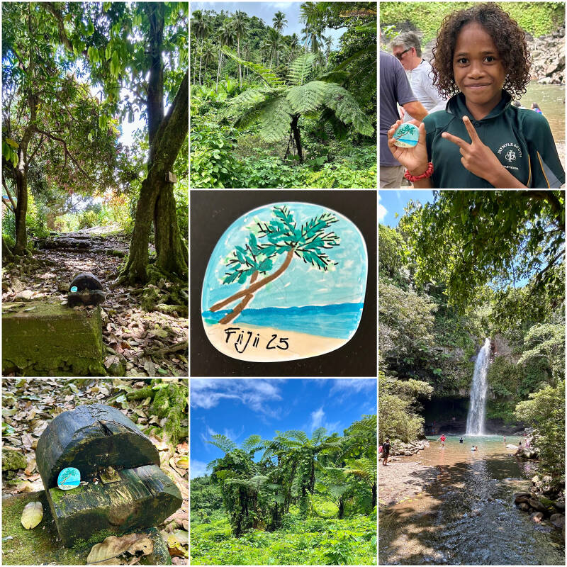
The next pearl on my trip across the South Sea is Taveuni. The Garden Island, across which the 180 degree meridian is located, is definitely a paradise. During my walk to the three waterfalls in Bouma Heritage Park I place my hiking stone FIJI 2025 in front of the first waterfall. And all at once Angelica, an eight year old Fijian Girl found it and will take it along to her home in the nearby village. There are definitely worse places to stay and I believe, Jürgen would love it here.
Die Insel ist 42 km lang und 15 km breit. Nur 15 km entfernt, jenseits der Somosomo-Straße, liegt die zweitgrößte Insel Fidschis, Vanua Levu. Taveuni ist auch unter dem Namen die Garteninselbekannt, da 60 % mit tropischem Regenwald bedeckt ist. Das Rückgrat der Insel bildet ein 16 km langer vulkanischer Rücken, ein Schildvulkan, der um 1550 das letzte Mal ausgebrochen ist. Am höchsten Punkt, dem Uluiqalau mit 1241 m, ergeben sich Regenmengen von bis zu 10.000 mm pro Jahr. Damit gehört Taveuni zu den regenreichsten Regionen der Erde. Die schönsten Wasserfälle Fidschis, die Bouna-Fälle, befinden sich auf Taveuni.
Taveuni is located at the northern end of the Koro Sea,[6] and is entirely the product of volcanic activity.[7] Fiji's third largest island is separated from Vanua Levu by the Somosomo Strait. The island is between 10 and 14 kilometres (6 and 9 miles) wide and 42 km (26 mi) long,[8] representing the top of a dormant, elongated shield volcano which erupted from a northeast–southwest trending rift on the ocean floor. About 150 volcanic cones dot the island, including Uluigalau, Fiji's second highest peak at 1,241 metres (4,072 feet), and Des Vœux Peak, next in height at 1,195 metres (3,921 feet). There have been at least 58 volcanic eruptions since the first human settlement around 950-750 BC,[7] all of which affected the southern two-thirds of the island. Major eruptions from 300 to 500 AD caused abandonment of the southern areas until about 1100 AD. The latest eruption produced a lava flow at the southern tip of the island around 1550. The island's central ridge delineates the greatest volcanic activity surrounding volcanic vents.
Kommentar hinzufügen
Kommentare